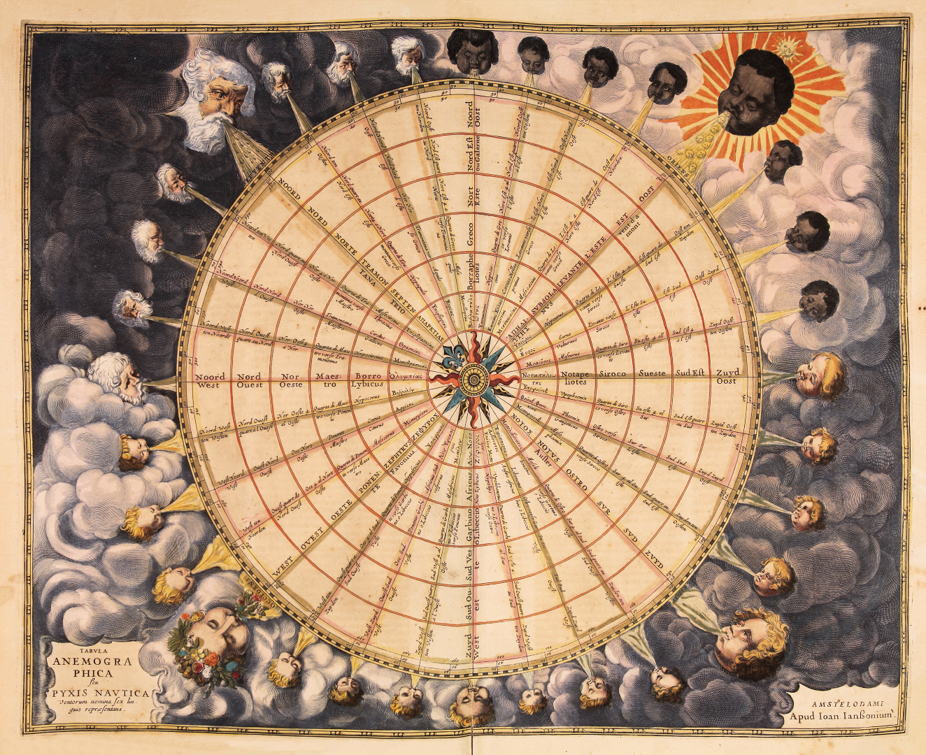
WIND ROSE
One of the main pieces on display is a chart, pictured below, from the 1650 Atlantis Maioris published by the cartographer Jan Jansson. The map, titled "Tabula anemographica seu Pyxis nautica", is one of the earliest compass rose charts ever made: the center compass branches out into a total of 32 different directions - each one representing a wind, each one personified by a human figure. The chart is thus divided according to the four cardinal directions: the upper left, representing North, depicts the northern wind as a bearded old man blowing rain and ice; East, on the contrary, is portrayed as a young black man surrounded by sun rays and breathing warm, "sunny" wind. The two figures in the lower half, both blond, represent the South and the West - the latter wearing a flower crown and blowing fresh flowers in the air.
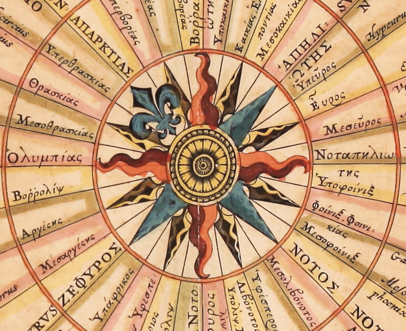
As for the central part of the chart, a sophisticated circle and degree system is used to compare the many names of the winds in 6 different languages - Greek, Latin, French, Dutch, Italian, and Spanish - so that travelers could easily figure out what foreign sailing books were referring to.
 [gallery size="large" columns="2" ids="17412,17411,17413,17415"]
 Engraved chart, colored by hand, from Jan Jansson's "Atlantis Maioris, quinta pars", 33.M.7, 1650, Biblioteca Estense Universitaria, Modena, Italy.
Folia Magazine wishes all of you the happiest of Holidays with this delicate,…
The cover page of the Paradiso displays an architectural structure that is complex…
As the three poets continue their journey through Purgatory, they reach the sixth…